The Point Reyes peninsula,
which “rides” on the eastern edge of the
northwestward-advancing Pacific Plate, abruptly ends in the
Pacific Ocean:
this “Point Reyes land's end” stretches for about
three miles from the western tip with the
Point Reyes Lighthouse
to the eastside tip called
Chinmney Rock.
Steep cliffs separate
this stretch of ragged headlands from the ocean to its south.
The Chimney Rock Overlook
is a great place to overview the surrounding ocean habitats
including Drakes Bay and the
Gulf of the Farallones—with
neighboring Monterey Bay farther south.
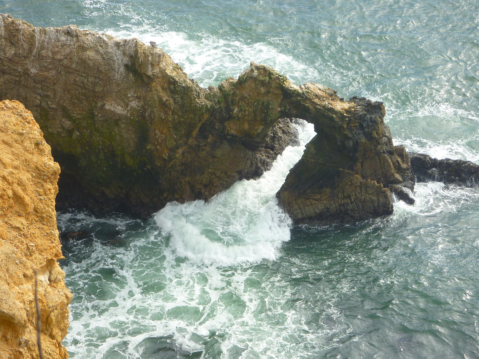
Looking down from the overlook, you will spot
sea stacks and
the fragile natural bridge,
shown in the picture above.
The cliffs at Chimney Rock (like all Point Reyes National Seashore cliffs)
have a tendency to crumble and slide.
The Chimney Rock Trail, beginning
at the parking lot east of the
Elephant Seal Overlook
provides safe access to the Chimney Rock overlook.
The narrow social trails leading to the
unstable cliff edges should only be
walked on (if at all) with extreme caution!