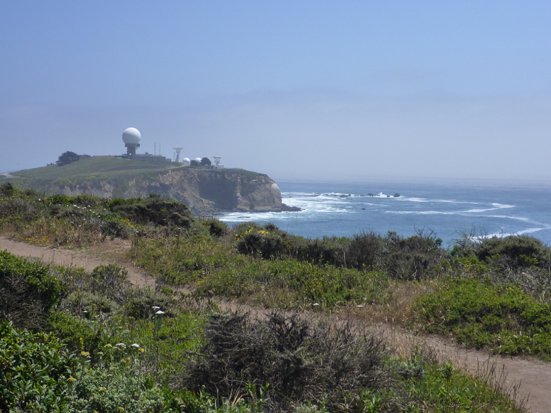

Pillar Point, seen by viewing south from
the Pillar Point Bluff trail area located
between the
Half Moon Bay Airport and the Pacific Ocean (June 2014)
Pillar Point is a rocky bluff
in San Mateo County, California. The
Pillar Point Air Force Tracking Station
on its hilltop is closed to the public. But the surrounding
ocean, beaches and scenic bluff trails
are publicly accessible—enjoyed year-round by surfers,
hikers and nature lovers.
The Pillar Point peninsula defines the northern part of
Half Moon Bay, separating
Pillar Point Harbor south of
Princeton-By-The-Sea from the
Mavericks surf break. The latter is
seen to the right of Pillar Point in the picture above.
The beaches, coves
and the intertidal zone with its tide pools and exposed rocks
stretching between Pillar Point and Kelp Cove further north
belong to the
James V. Fitzgerald Marine Reserve.
The U.S. Army bought the Pillar Point peninsula headlands
during World War II
[see Cultural Resources Management Plan]:
The Pillar Point peninsula was originally part of the Rancho Corral de Tierra. This land was granted by Mexico to Francisco Guerrero Polamares. The peninsula was used primarily for farming and grazing until October of 1940, when the U.S Army bought 12.68 acres on Pillar Point. The main concern was that the Japanese would attack San Francisco, and the Army wanted to use the site as an artillery observation post.
In 1959, the site was transferred from the Army to the Navy. Since 1965, the Air Force is administering the Pillar Point installations.